
Water Resource Management BMPs for Golf Courses in Louisiana and Mississippi
Preface
This publication is the second in a series addressing best management practices for Louisiana and Mississippi golf courses. The first publication, Nutrient BMPs for Golf Courses in Louisiana and Mississippi (LSU Ag Center Pub. 3619), addresses many issues that are equally important to protecting water quality on golf courses.
Authors
Jay McCurdy, Mississippi State University
Beth Baker, Mississippi State University
Stacia Davis Conger, Louisiana State University AgCenter
Jeff Beasley, Louisiana State University
Brian LeBlanc, Louisiana State University AgCenter and Sea Grant
Louisiana-Mississippi Golf Course Superintendents Association BMP Committee
Stephen Miles, Preserve Golf Course
Jeremy Stevens, Preserve Golf Course
Mitch O’Banion, Money Hill Golf and Country Club
Brandon Reese, TPC Louisiana
Ron Wright, Golf Course Superintendents Association of America
Other Contributions and Reviews
Al Hindrichs, Louisiana Department of Environmental Quality
Coen Perrot, Mississippi Department of Environmental Quality
Florance Bass, Mississippi Department of Environmental Quality
Chris Coreil, NRCS, Alexandria, LA
Troy Mallach, NRCS, Alexandria, LA
Jim Kwasinski, Mississippi University for Women
Pat Sneed, Mississippi State University Golf Course
Brent McBrayer, Dancing Rabbit Golf Course
Stanley Reedy, Jackson Country Club
Britt Pollock, Northwood Country Club
Alan Sullivan, Grand Bear Golf Course
Introduction
The need to protect water resources, especially surface and groundwater quality, is a serious environmental issue. Nonpoint source pollutants, or pollutants coming from sources spread out over a large area across a landscape, are the most common threat to water resources. Thoughtful design and responsible management can improve water quality on (and off) the golf course. This goal requires having a sustainable view during construction and renovation of golf courses that takes into account the big picture and benefits everyone involved, both environmentally and economically.
The local environment and associated potential issues should be considered during design and construction of a golf course. The careful evaluation of specific site characteristics that affect water management (for example, impervious surfaces, slopes, and existing and potential wildlife habitats) should be performed in a professional manner that incorporates all stakeholders, such as developers, designers, and the community. Likewise, additions or renovations to existing golf courses should preserve or enhance the established ecosystem by considering various existing natural and man-made water features and habitats.
There are three key steps to designing, building, and operating an environmentally responsible golf course with emphasis on water management:
- Create a sustainable design.
- Create a natural-resources management plan for construction and routine maintenance.
- Consider implementing an environmental monitoring program.
Professionals and experts, including engineers, agronomists, wildlife specialists, architects, and other specialists, should be involved throughout these steps when necessary.
Sustainable Design
A golf course should be designed so that it can be managed sustainably for long-term success by maintaining the natural ecosystem while addressing the needs of the golf course. A sustainable design should enhance the natural landscape, promote the beauty inherent to the area, and protect the environment. Though some aspects of a good design may seem costlier up front, incorporating the natural features and maintaining proper water management can reduce the need for future investments in renovations, updates, and changes while maximizing time for gameplay. A sustainable golf course design includes the following components:
- Performing a site assessment in relation to the local ecosystem,
- Incorporating drainage features,
- Accounting for various potential flooding conditions, and
- Following all federal, state, and local laws and regulations.
Site Assessment
Planning and project implementation should keep a clear focus on utilizing natural resources, especially protecting water resources within the design. The first steps in conducting a water resource assessment should be watershed identification, course mapping, and conducting an environmental inventory.
Watershed Identification
Undoubtedly, there will be times when water enters the property from adjacent landscapes and exits via downstream water bodies. Knowledge of where those water bodies are, and their designated use, will help to determine water quality compliance standards. Prior to course construction or renovation, one should investigate adjacent water bodies and the associated regulatory requirements in order to protect surface and groundwater quality.
Course Mapping
Mapping the course will provide an overview of the landscape, revealing connections between natural resources, and allow for the identification of the site’s physical and biological attributes. Potential elements that should be included in mapping efforts:
Overview of the landscape
- Identify surface water flow patterns into and out of the land area.
- Identify soil types and any limitations or characteristics of associated mapping units.
- Identify adjacent land-use areas that might impact management goals.
- Designate environmentally sensitive areas such as wetlands, sinkholes, flood-prone areas, and seasonal pools.
- Map vegetation and habitat types, including those that support threatened and endangered species, biodiversity, mature areas, and areas of special economic, commercial, or recreational value.
Connections between natural resources
- Identify position of the property within the watershed/drainage area.
- Quantify existing and potential storage of surface runoff.
- Identify hydrological connections between the course and local water bodies.
- Determine if the watershed has any previous or existing water impairments by checking the state’s Clean Water Act Section 303(d) list and Section 305(b) report of impaired waters for the past 10 years.
Identification of the site’s physical and biological attributes
- Plan impervious surfaces so that they are minimal and connected to pervious areas to encourage infiltration.
- Locate existing utilities such as electricity, natural gas, irrigation, and sewage.
- Locate potential connections to surface water and groundwater assets and wellheads.
Environmental Inventory
Having a visual inventory of water resources, landscape features, and position in the watershed will make it much easier to plan successful improvements to protect water resources. Additionally, knowing which watershed the site is in and adjacent to, is critical to determining if there are water quality standards the course should comply with and if impairments exist. A survey of this nature will allow the design team to identify critical areas for best management practice (BMP) implementation and natural resource protection areas.
Drainage
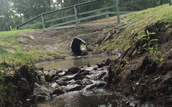
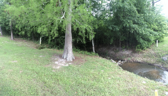
Drainage can be defined as the removal of excess water from the land surface. The two types of drainage are internal drainage, where water infiltrates the land surface and is ultimately stored within the soil, and surficial drainage, where water becomes surface runoff and attempts to exit the landscape. Sometimes, the only difference between generating internal or surface drainage is the residence time of the water in a specific location. Soils with low infiltration rates will require higher residence times. However, any soil can generate surficial drainage considering the slope of the area and the intensity of the precipitation (for example, flash flooding). Internal drainage is preferable to surficial drainage in most cases and should be a part of the overall golf course design if possible. However, if existing drainages (ditches, creeks, small streams) naturally drain to local water bodies, then those connections should be preserved within the design in an effort to minimize ecological impacts.
Good internal drainage is a key component of golf course design and is the best way to maintain turfgrass health and playability after rainfall. Having knowledge about the characteristics of the existing soil structure and texture is imperative to the design process, as the native soils should be preserved, if possible, for environmental and economic reasons. Soils with low infiltration rates and low hydraulic conductivities may require amendments to improve drainage. Turfgrasses with shallow root systems, such as those found on golf greens, require good-quality construction to promote internal drainage but also to create a perched water table to minimize the need for irrigation (see USGA standards for green construction).
Internal drainage may be improved through vegetation selection and management. Soil structure, thus internal drainage, is heavily influenced by plant species selection and management. Root development generally mirrors above-ground growth unless significant compaction exists to restrict root growth. Compaction testing may reveal restrictive layers caused by past equipment traffic or soil smearing from tillage equipment. Outside of high-management zones (greens, fairways, tee boxes, etc.), waste areas can be established with introduced or native species. In these areas, reduced vegetative management and traffic can lead to better soil structure and internal drainage for the entire course watershed. These areas also benefit wildlife species, including pollinators and other beneficial insects.
If internal drainage becomes restricted, it becomes surficial drainage. Surficial drainage is normally generated from precipitation as surface runoff, which occurs when the rainfall does not absorb into the soil or evaporate into the atmosphere. Surface runoff flows naturally or in man-made confluence features, enters into local water bodies, and eventually reaches the ocean. Along the way, it picks up pollutants that may impair water quality. Surface runoff is generated by all land surfaces (large and small), including golf courses. Properly managed surface runoff is retained such that it releases slowly over time through vegetative outlets to prevent erosion, filter pollutants, and promote natural ground water recharge through internal drainage.
The storage capacity for surface runoff is designed using a specific rainfall frequency of statistical significance. For example, a golf course drainage system could be designed to process a 2- or 5-year rain event. This means that there is enough storage to handle the volume of water that statistically occurs once every 2 years or once every 5 years, determined based on historical records. In some instances, golf courses and other recreational facilities are designed to handle 20-year, 50-year, or even 100-year rainfall events, which means the golf course must process more water for perhaps a longer period of time. The design should incorporate the largest storage capacity possible that also balances the financial and physical restrictions.
In addition to volume, golf courses should be designed to improve the water quality of surface runoff, as it is the conveying force behind nonpoint source pollution. Nonpoint source pollution, occurring both naturally and by humans, may include sediment, trash, debris, nutrients, fertilizers, metals, microplastics, pesticides, petroleum products, paint particles from car washing, leaves and grass clippings, and pet and wildlife wastes. The most effective method of treatment is by preventing contaminated surface runoff completely. However, the removal of pollutants can be accomplished by routing water through various areas that contain natural systems contributing to the treatment. Contact area and time between the water and the natural system are critical to the effectiveness of the treatment. It is important that water flow as unrestrictedly as possible into these natural systems and not through pipes or gutters that dump directly into storm drains, streams, wetlands, or water bodies. In this same spirit, architects and designers should eliminate or minimize contiguously connected impervious areas, such as buildings and adjacent parking areas, as well as channelized or piped waterways, by integrating natural systems. Types of drainage systems include the following examples.
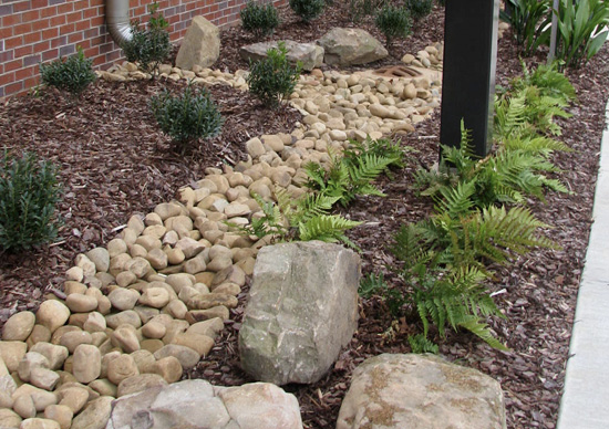
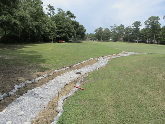
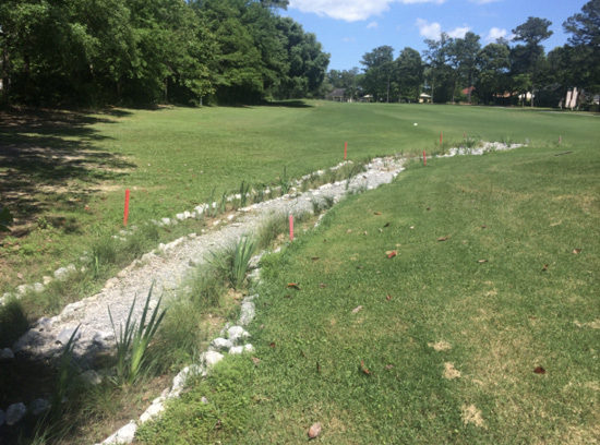
Bioswales
“Bioswale” is a general term given to any vegetated swale, ditch, or depression that transports stormwater. The two basic types of bioswales include fully vegetated and open channel, differentiated only by the amount of vegetation. Subtypes of bioswales are specified by their shape (U-shaped, V-shaped, and trapezoid).
Pros: Bioswales provide good treatment of stormwater runoff without extensive maintenance compared with other drainage systems, they slow water to improve infiltration and reduce sedimentation, and they trap pollutants in the soil where they can be naturally degraded by by soil organisms and sunlight or phytoremediated by plants.
Cons: Though most bioswales are beneficial for infiltration, only fully vegetated trapezoidal bioswales provide the full benefits of bioremediation.
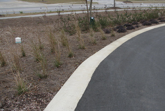
Vegetated Filter Strips
Vegetated filter strips provide a vegetated buffer between an area with the potential for generating polluted waters (for example, a fertilized fairway) and a water body, such as a ditch, stream, or lake. They tend to be incorporated around boundaries of water bodies and provide erosion control along the banks.
Pros: Vegetative filter strips slow runoff for higher infiltration, lower peak volumes, reduce sedimentation, and remove some nutrients and pesticides before runoff enters the water body.
Cons: Vegetated filter strips are not designed to have depressions that store surface runoff, resulting in less bioremediation compared with fully vegetated trapezoidal bioswales. Grasses should be protected from mowing to maximize the potential for pollutant removal, and alternative ground covers should be explored if this will be an issue.
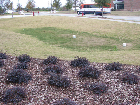
Depressed Landscape Islands
Sometimes called a bioretention area, a depressed landscape island is a low area that collects water from impervious surfaces for temporary storage and infiltration. These systems may include elevated stormwater drain outlets that allow the island to hold water while settling out sediments and draining overflow more slowly. These areas should be planted with native plant species such as grasses, flowering perennials, woody shrubs, trees, or a combination of these elements to enhance plant water uptake and infiltration. Architects and designers may use depressed landscape islands in parking lots to catch, filter, and infiltrate water, instead of elevated curbs that direct untreated water into storm drains.
Pros: These cost-effective systems help to filter pollutants in runoff while providing food and shelter for wildlife, including butterflies, bees, and birds.
Cons: Poor engineering design or lack of regular landscape maintenance can cause clogging, reduced storage capacity, or low infiltration into the soil.
Neat Fact: Rain gardens fit into this category, but they may not always have drainage systems or engineered soils.
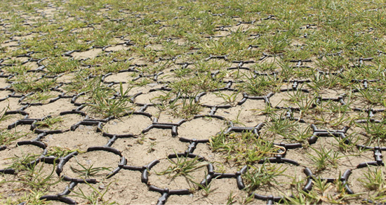
Permeable Paving
Permeable paving consists of the use of pavement that allows for the infiltration of water, either directly through the porous material or through the spaces between the nonporous materials. Runoff from gutters and roof drains should flow across permeable areas that allow water to infiltrate near the point of generation rather than piping them onto impervious surfaces or into storm drains. When possible, architects and designers should maximize their use of pervious pavements, such as brick or concrete pavers separated by course aggregate or planted with ground cover/turfgrass. Examples of permeable pavements include pervious concrete, porous asphalt, paving stones, or plastic-based pavers.
Pros: Permeable paving can handle heavy loads, such as cart paths or parking lots, in addition to managing surface runoff and controlling pollutants. It also allows the incorporation of trees into the landscape by expanding the available root space with access to water for healthy and mature growth.
Cons: Permeable paving is meant to handle infiltration of precipitation occurring on its surface and not from other areas of the golf course. Though it can handle heavy loads, permeable pavement may not be appropriate for high-traffic areas and requires frequent maintenance to remain permeable over the long term.
Treatment Wetlands
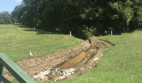
Wetlands are water-treatment systems that use vegetation, soils, and microbiology to improve water quality. Natural water conveyance features are not channelized. During heavy precipitation, they are allowed to escape their banks and widen. When streams widen, their velocity slows, and sediment can fall out of solution. These flood plains allow groundwater recharge and provide natural detention basins where nutrients and sediment are retained.
Pros: Wetlands act as filters for pollutant removal and provide important habitat for wildlife and aquatic organisms. The biological activity of a healthy wetland recycles nutrients and organic matter before it can cause impairment of downstream waterways. When incorporated into a golf-course design, wetlands should be maintained as preserves and separated from managed turf areas with native vegetation or structural buffers.
Cons: Constructed or disturbed wetlands may need to be permitted to be an integral part of the stormwater management system. Most states consider wetlands as “waters of the state,” a designation that carries significant legal ramifications. Furthermore, permitting requirements for wetlands can have multiple overlapping jurisdictions of federal, state, and local agencies. At the federal level alone, the U.S. Army Corps of Engineers, Environmental Protection Agency, U.S. Fish and Wildlife Service, National Oceanic and Atmospheric Administration, and maritime agencies may all be involved.
Ideally, golf course designs can take advantage of natural water systems through reestablishment in an effort to control surface runoff from stormwater. To accomplish this goal, golf-course architects and superintendents must address sediment and nutrient loads, as well as stream migration that causes unstable banks, flooding, and reductions in groundwater recharge. This may be done by restoring native flood plains and by allowing streams to return to their natural meandering state. Naturally occurring stream flows should not be changed (indicated as unbroken blue or purple streams on U.S. Geological Survey topographic maps). Also, keep in mind, natural waters or wetlands cannot be considered treatment systems and must be protected.
The following is a summary of best management practices for drainage:
- Incorporate multiple drainage systems in series throughout the golf course design to maximize the benefits of each system, such as restraining the flow, promoting infiltration, trapping pollutants, and creating biodiversity.
- Eliminate or minimize impervious areas in series as much as possible by disconnecting direct connections (for example, gutters to parking lots) so that stormwater flows onto permeable areas that allow the water to infiltrate near the point of generation.
- Ensure that there are no direct connections from sources, such as gutters, subsoil drainage, French drains, and wash pads, to water bodies without first filtering through at least one of the drainage systems.
- Reduce nonpoint source pollution from entering stormwater by preventing its occurrence or by capturing and disposing of it properly. Specifically for golf courses, this includes proper waste disposal with protection from wind dispersion or overflow (for example, trash and recycling receptacles with lids) and installing sediment catch basins at wash stations. Sediment should be disposed of as waste.
- Allow and encourage natural areas with native vegetation that naturally reduce surface runoff and protect water quality while also creating buffers for benefiting wildlife habitat, reducing urban noise, and minimizing visual distractions.
- Conserve natural wetlands and avoid the incorporation of chronically flooded wetlands—as they are not suitable for turf growth and playability—in golf course design.
Flooding
Flooding typically occurs when rainfall volume exceeds the storage capacity for surface runoff. It can occur naturally from heavy rainfall, accelerated snowmelt, high winds over water, unusually high tides, and failure of water control structures within the watershed. It can be exacerbated by human activity such as land grading, building impervious structures, and removing natural vegetated areas that can absorb rainfall. Flood management strategies, including capture systems, should be included as part of the overall treatment of surface runoff in combination with best management practices for drainage. Most golf courses plan their water features to contribute to the control, storage, and treatment of surface runoff. In most cases, natural water systems such as creeks, rivers, and streams cannot be impounded without regulatory approval. There are several types of flood-management systems.
Detention Basin
A detention basin is a normally dry vegetated depression designed to hold surface runoff from an extreme precipitation event such as the 100-year storm and discharge slowly from an outlet located at the lowest point of the basin. They are also called dry ponds or holding ponds. Bunkers are not considered detention basins due to their repair costs and potential for sand erosion.
Pros: These basins are excellent in minimizing stormwater impacts due to their large storage capacity. They typically require less maintenance than other systems.
Cons: Detention basins have very little effectiveness in addressing water-quality concerns.
Neat Fact: Typically, storm drains from impervious surfaces are routed directly to a detention basin. Since the 100-year storm can produce a significant volume, outlets into the basin tend to be structural with entrance spillways and debris drop vaults that collect landscape debris.
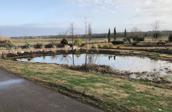
Retention Basin
Sometimes called a wet pond or wet detention pond, a retention basin is a permanent pool of water designed to receive large amounts of surface runoff that discharges slowly through outlet structures when required.
Pros: These biologically active systems are designed to improve water quality, provide flood protection, encourage groundwater recharge, and be aesthetically pleasing.
Cons: Improperly designed basins can increase downstream flooding and peak flows instead of managing them. Lack of biodiversity along the edge of the basin can attract nuisance wildlife and reduce the water-quality benefits.
Neat Fact: The critical transitional area around the basin is called the littoral shelf. The shelf should gradually slope unevenly into the basin and contain multiple plant species to promote biodiversity. The shelf should account for approximately 30 percent of the land area of the basin.
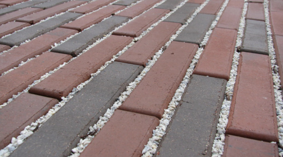
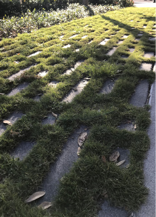
Figure 5 and 5-1. Maximize the use of pervious pavements. Grass is usually only suitable in between pavers when a soil is engineered to retain nutrients and appropriate moisture. The use of “grass-crete” is not recommended for high-traffic areas without irrigation and proper maintenance.
Infiltration Basin
An infiltration basin is a normally dry vegetated depression used to encourage groundwater recharge by collecting surface runoff for infiltration through highly permeable soils. Water may also leave the basin by evaporation or by an overflow if water levels exceed capacity. These basins can also be called recharge basins or percolation ponds.
Pros: Infiltration basins have large surface runoff storage that directly contributes to groundwater recharge. They are very effective at pollutant removal since the water does not exit the system directly.
Cons: These basins should not be used in areas where there is a high groundwater table, compacted soils, high clay content, or likelihood of significant sediment in the surface runoff.
Weirs, Dams, and Other Barriers
These barriers are obstructions used to hold back water, raise the upstream water level, and control the flow rate. They’re typically used in channels that convey water to the appropriate storage system or as control structures on the inlets and outlets of storage systems. In some instances, these structures must be designed to meet the standards set by the U.S. Army Corps of Engineers and possibly state agencies.
Pros: Barriers can be used to slow rapid or turbulent channels into potentially navigable waterways for additional recreational opportunities. Weirs, specifically, can help to measure the flow rate to determine the volume of water moving through the system. They can also control the spread of invasive species.
Cons: Since these barriers change the hydrological characteristics of the watershed, they can also cause ecological changes by altering fish habitats, preventing fish migration and reducing spawning habitat, and increasing upstream siltation that reduces oxygen content. Siltation may also reduce storage capacity over time, thus requiring periodic dredging. Additionally, there are potential safety concerns on the downstream side of barriers where discharged water can create a hydraulic jump, trapping humans or animals underwater if they come in contact.
Captured rainwater can help supplement irrigation needs of a golf course through the process of water harvesting. Backup sources may be needed during drought conditions or when impounded waters are not of high enough quality for use on the course. The reuse of captured stormwater for irrigation is desirable when water quality is poor to conserve potable sources, maintain hydrologic balance, and provide better water treatment.
The best management practices for flood prevention include the following steps:
- Incorporate flood-control structures, such as capture systems and restrictive barriers, into the overall stormwater-management plan as a way to reduce flooding by providing storage while also reducing flow rates and providing water treatment.
- Ensure the proper design of storage basins to prevent flooding, detain stormwater for as long as practical for treatment and harvesting, and reduce the likelihood of algal growth, excess sedimentation, and low oxygen levels that cannot support healthy aquatic life.
- Incorporate a variety of native vegetation along the edges of basins, especially at inlets and outlets, for best effectiveness of water treatment and creating biodiversity.
- Refrain from lining/sealing a pond to store water because it alters the natural hydrological cycle and restricts the important function of groundwater recharge, which is extremely important in water-stressed areas.
Laws and Regulations
The current federal regulations for water-quality standards, including discharge into water bodies, are specified by the Clean Water Act of 1972 (CWA). Through the CWA, permits are required for discharging into navigable waters, and compliance monitoring may be required. Golf courses are responsible for complying with the regulations and are subject to requirements of federal permitting. The EPA and U.S. Army Corps of Engineers are responsible for investigating and enforcing the regulations at the federal level, but they may collaborate with state or local officials.
Federal Level
Navigable waters of the United States (WOTUS) are defined as all waters that are subject to the ebb and flow of the tide and/or used to transport interstate or foreign commerce presently, in the past, or susceptible for future use. The interpretation of this definition is subject to change, so the recommendation to consult an expert at the time of course development or modification is advised.
Dredging, filling, discharging into, or otherwise altering WOTUS without authorization may be subject to civil and criminal penalties. Consult an expert if you are unsure if WOTUS exists on or adjacent to the golf course. The following summaries of legislation provide more information about specific permitting procedures.
Section 401 of the CWA requires that any person applying for a federal permit or license, which may result in a discharge of pollutants into WOTUS, must obtain a state water-quality certification that the activity complies with all applicable water quality standards, limitations, and restrictions. No license or permit may be issued by a federal agency until certification required by section 401 has been granted. Further, no license or permit may be issued if certification has been denied. Including this 401 certification step allows states and tribes to take a more active role in decisions impacting aquatic resources for better consideration of local concerns in the federal permitting process. In most cases, Section 401 certification review is conducted at the same time as the federal agency review for a Section 404 permit. More information about Section 401 permitting can be found at https://www.epa.gov/cwa-404/clean-water-act-section-401-certification.
Section 402 of the CWA requires National Pollutant Discharge Elimination System (NPDES) permits for all discharge from point sources into WOTUS. The purpose of this permit is to maintain water quality and human health by upholding discharge, monitoring, and reporting standards. This permit can be considered a tailored plan specific to the golf course for meeting the CWA requirements. Though the NPDES permit is federally mandated, the states hold complete, partial, or no regulatory authority. Complete authority has been given to Louisiana and Mississippi. More information about NPDES permits can be at https://www.epa.gov/npdes/npdes-permit-basics.
Section 404 of the CWA establishes a program that regulates the discharge of dredged or fill material into WOTUS, especially wetlands. The goal of this permit process is to eliminate losses of wetlands by requiring mitigation and restoration. Activities in WOTUS regulated under Section 404 include fill for development, water resource projects, infrastructure development, and mining projects. Following is the federal definition of wetlands:
Those areas that are inundated or saturated by surface or groundwater at a frequency and duration sufficient to support and, that under normal circumstances, do support a prevalence of vegetation typically adapted for life in saturated soil conditions. Wetlands generally include swamps, marshes, bogs and other similar areas.
In order to determine whether an area meets this definition, a professional would look for these criteria:
- Hydrophytic vegetation — vegetation that grows, competes, reproduces and/or persists in anaerobic (no oxygen) conditions (in other words, under water).
- Hydric soils — soils that are saturated long enough during the growing season for anaerobic conditions to develop in the upper part.
- Wetland hydrology — inundated by water sufficient to support hydrophytic vegetation and develop hydric soils.
All three criteria must be present under normal circumstances for an area to be determined as a jurisdictional wetland. For examples of the above areas, see www.epa.gov/owow/wetlands/.
Generally, golf courses are not exempt from Section 404 permitting, though some situations can be exempt. Even if an activity is listed as exempt, a permit is still required if it results in a reduction in reach or impairment of flow or circulation of regulated waters, including wetlands. Section 404 permitting is overseen jointly by the Department of Environmental Quality, the U.S. Army Corps of Engineers, the U.S. Fish and Wildlife Service, and the National Marine Fisheries Service. More information about Section 404 permitting can be found at www.epa.gov/cwa-404.
State Level
The states have the authority to determine their own water-quality standards to protect human health and the environment by preventing pollution. Many states utilize a classification system to separate water-quality standards based on intended use. For example, the water quality of surface runoff discharged into a water body that was classified for drinking water may have higher treatment standards than if discharged into a pond classified for agricultural irrigation. Mississippi and Louisiana have designated use classifications of their water bodies to determine water-quality criteria.
Mississippi water-quality criteria are dependent on four designated use classifications: public water supply, recreation, shellfish harvesting, and fish and wildlife. If a water body does not have a designated classification in Mississippi, it defaults to fish and wildlife use. All specific water-quality criteria associated with each designated use classification for Mississippi can be found in the Mississippi Commission on Environmental Quality Regulations for Water Quality Criteria for Intrastate, Interstate, and Coastal Waters Adopted by Commission on Environmental Quality (www.epa.gov/sites/production/files/2014-12/documents/ms-wqs.pdf).
Louisiana utilizes seven designated-use classifications: primary contact recreation, secondary contact recreation, fish and wildlife propagation, limited aquatic life and wildlife use, drinking water supply, oyster propagation, agriculture, and outstanding natural resource waters. All specific numerical criteria and designated uses for water bodies in Louisiana can be found in Chapter 11 of Surface Water Quality Standards, Section 1105, Environmental Regulatory Code (www.epa.gov/sites/production/files/2014-12/documents/lawqs.pdf).
The 303(d) list is a state’s list of impaired and threatened waters, such as lakes or stream/river segments, that still require development of a Total Maximum Daily Load (TMDL). States are required to submit their list for EPA approval every 2 years. For each water body and impairment on the list, the state identifies the pollutant causing the impairment, when known. In addition, the state assigns a priority for development of TMDLs based on the severity of the pollution and the sensitivity of the uses to be made of the waters, among other factors. A state’s 303(d) list is often a subset of its 305(b) reports. The TMDLs establish load allocations (nonpoint sources) and waste load allocations (point source discharges) implemented to restore impaired water bodies. After a TMDL has been completed for a water body and impairment combination, then the impairment is no longer considered on the 303(d) list. However, it is still reported on the state’s 305(b) report. It is important to know if a water body on a golf course property or adjacent to the property is listed on the states 303(d) list or 305(b) report.
The 305(b) report is a state’s complete report of both impaired and unimpaired water bodies. A water body may be impaired but not on the 303(d) list because a TMDL has already been completed. If a TMDL is present, it should be implemented based on state requirements for permitted dischargers or based on BMPs (nonpoint sources). If a water body is impaired but a TMDL has not yet been developed, then BMPs for nonpoint source pollution or point-source pollution permits should still be implemented.
303(d) lists and 305(b) reports respective of states can be found online:
Mississippi — https://www.mdeq.ms.gov/water/surface-water/tmdl/
Louisiana — https://www.deq.louisiana.gov/page/2022-water-quality-inventory-integrated-report-305b303d
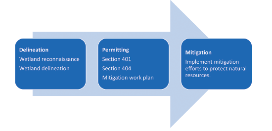
The Permitting Process
The first step in the process of permitting should be a wetland delineation verified by the Corps of Engineers. A wetland reconnaissance survey is a general property assessment to determine if critical areas are present on a property. If none are found, the report may be used for permitting purposes. However, a detailed wetland delineation is required for permitting if a wetland is present. It is advisable to first consult a professional to perform a wetland reconnaissance survey or a delineation. A majority of all wetland delineations are prepared by consultants and verified by the Corps. An additional resource is the National Wetlands Inventory, an integration of digital maps and historic analyses of wetlands, riparian, and deepwater habitats (https://www.fws.gov/wetlands/data/mapper.html).
After the delineation process, the professional consultant can and should prepare and submit the permits on behalf of the golf course. If the permitting agency determines that there is a possibility for negatively impacting the water quality of WOTUS, mitigation may be a stipulation of obtaining and remaining in good standing of the permit requirements.
Natural Resources Management Plan
As its own best management practice, a Natural Resources Management Plan should be developed to ensure that future decision-making fits the scope of the goals instead of making short-term decisions that create adverse and costly long-term consequences. This document should be developed simultaneously with the information collected during the development of the sustainable design and permitting process. It should also be reviewed on a regular schedule, such as a 5- or 10-year rotation, and updated after changes to the environment, both occurring naturally and through golf course renovation. This document should be easily understandable and contain the following information.
Objectives
The objectives are achievable goals for the golf course that will drive the plan for natural resources management. The goals should be developed based on the priorities determined during the permitting process as well as the priorities for operating the golf course itself. In most cases, achieving the objectives should result in a sustainable golf course operation.
Property Location and History
At minimum, this part of the plan should include a description of the land including an official survey map completed by a licensed surveyor. Additional maps focused on the property itself may be necessary depending on the resource concerns affecting the golf course. Aerial photographs should also be included, if possible. This section is also a good place to record the management history of the property to aid in future decision-making.

Resource Assessment
This section of the plan describes the natural resources located on or adjacent to the property. Types of resources may include vegetation types, soils, water bodies, historical features, wildlife uses, and recreational opportunities. Following are examples of site references:
- Web Soil Survey, which includes information about soil texture, land classification, inherent internal drainage characteristics, etc.)
https://websoilsurvey.sc.egov.usda.gov/App/HomePage.htm - Louisiana Department of Environmental Quality
https://deq.louisiana.gov/ - Louisiana Department of Wildlife and Fisheries Scenic Rivers Survey
https://www.wlf.louisiana.gov/page/scenic-rivers - Louisiana Department of Natural Resources, which has information about water extraction and aquifers
http://www.dnr.louisiana.gov/ - Mississippi Department of Marine Resources
https://dmr.ms.gov/ - Mississippi Department of Environmental Quality
https://www.mdeq.ms.gov/
Management Recommendations
This section details the operations that will be used to meet the long-term objectives based on the outcome of the resource assessment. The recommendations should list the general operations for the golf course and break out into specific management descriptions that will achieve the objectives. Some specific areas may require targeted management strategies in addition to the general recommendations. For example, a general recommendation could be described as maintaining stormwater systems to their full potential functionality, and the specific recommendations could include detailed maintenance requirements, instructions for maintaining biodiversity, and financial considerations for alternatives to meeting the recommendation.
There may be specific management considerations during certain situations that should also be detailed. For example, water-resource management requires appropriate mitigation techniques (such as silt fencing, temporary barriers, or traps) to prevent sediments from being washed off site and into local water bodies during construction and/or renovation. Wherever possible, a vegetative cover should be maintained on the site until it is ready for construction, and then revegetated as soon as possible to prevent erosion.
Activity Schedule
This schedule should list necessary activities and their expected timetable for completion. Additionally, this section should be used as a continuous record of completed activities, including expenses, income, dates, places, and workers and professionals involved. An example of an activity could be the regular inspection of weirs and dams for debris and damage that may impact the function of the control device.
Supplemental Information
This part of the plan is a good place to add appendices that may help in making future decisions. Examples of appendices could include detailed financial records, lists of professionals and services with contact information, and references such as research or Extension publications.
Optional Environmental Monitoring Program
Water-quality monitoring is an option that should be considered. It can be used to determine whether outside events are changing the water quality entering the golf course or whether the golf course is having an effect (positive, negative, or neutral) on water quality exiting the golf course. It also provides a body of evidence of the golf course’s environmental impact by establishing a baseline for conditions when the project started and provides an early warning of potential problems that may arise, before they become serious or expensive to address. A water-quality monitoring program will ensure the ongoing protection of water quality and provide defensible evidence that the golf course is compliant with all water-quality standards set by the state regulatory agency.
Monitoring Design and Implementation
Overall design and implementation of a water-quality monitoring program requires an understanding of watershed dynamics, hydrology, ecology, and water quality. For golf courses in the planning stage, baseline water quality levels should be measured before construction at points of entry and exit of flowing water on or surrounding the golf course and within other primary surface waters (ponds or lakes). This information can be used to form an understanding of baseline of flow and nutrient/chemical levels. For established courses, ongoing, routine water sampling provides meaningful trends over time.
After collection of baseline water-quality data, sampling should be planned for after construction is finished. Postconstruction surface-water-quality sampling should begin following the installation and maintenance of golf-course turf and landscaping. Once construction is complete, periodic water sampling is recommended. Periodic sampling could range from monthly to three or four times a year, depending on budget, time, and labor constraints. Periodic sampling should be conducted at consistent time intervals and should consider seasonal fluctuations in landscape management (fertilizer and pesticide applications) and rainfall. Should there be no discharge on the scheduled sample date, samples should be taken during the next discharge event. Postconstruction surface-water-quality sampling should continue through the first 3–5 years of operation. Due to annual fluctuations in climate and rainfall in Mississippi and Louisiana, it is recommended that annual sampling during wet and dry seasons continue voluntarily, even if all water-quality standards are met in the initial 5-year period. It may also be wise to sample if a significant change has been made in course operation or design that could affect nearby water quality. Ongoing, routine water sampling provides meaningful trends over time.
The purpose of quality assurance/quality control (QA/QC) is to ensure that chemical, physical, biological, microbiological, and toxicological data are appropriate and reliable, and that they are collected and analyzed using scientifically sound procedures. It is strongly recommended that a certified laboratory be used even if the data are only for proprietary use and are not reported to any regulatory agency. QA/QC procedures should be followed. Golf-course managers require sound data to make decisions, and if a golf course should ever want to produce data for an agency or to use in court to defend the facility from unwarranted charges, those data need to meet QA/QC standards to be defensible as evidence.
The best management practices for designing and implementing a water-quality monitoring program include these steps:
- Identify the appropriate sampling locations to collect the most meaningful data. Though there may be additional sampling locations in the future, the initially selected locations for sampling should remain the same over time.
- Identify an acceptable sampling rate that provides the most information economically. A seasonal sampling program (four samples per year) is recommended. Semiannual testing is acceptable once baseline data is established.
- Establish baseline water quality data before any construction or renovation processes to estimate change in water quality over time.
- Seek professional assistance from an environmental specialist to design an appropriate water sample collection strategy.
Sample Collection and Handling
The number of samples per course is highly variable and depends on the size, location, and number of water sources on or near the golf course. The entry and exit points of golf-course water sources are logical sampling points. However, sampling and analysis of standing water sources (ponds and lakes), springs, and any other potential irrigation sources could also be conducted.
Golf-course personnel may collect water samples for analysis, but it may be more efficient to contract with a consulting firm, university, or laboratory to collect samples and conduct the analysis. Grab water samples can be collected by simply acquiring sterile sampling jugs from an environmental monitoring company, and then collecting samples from the various sampling points; this should be done at the same time of the day. Be sure to follow the recommended collection and handling procedures of the analytical lab you are contracting with if you are collecting samples independently. It is recommended to also collect discharge or flow data, so that “loads” of water quality parameters can also be determined.
Sampling parameters are determined based on golf-course operation and basin-specific parameters of concern (these may be identified by local/state TMDL or permitting programs). Typically, samples can be analyzed for temperature, dissolved oxygen (DO), pH, conductivity, nitrogen, phosphorus, bacteria, chlorophyll a, benthic macroinvertebrates, turbidity or suspended solids, metals, and any pesticides expected to be used on the golf course.
Sampling for benthic macroinvertebrates (insects, worms, and larvae larger than ¼ mm) can be a useful and cost-effective way to monitor water quality, as these bottom-dwelling aquatic invertebrates are biological indicators that reflect current ecological conditions and cumulative impacts from environmental stress over time. However, results from sluggish bayous, ponds, and wetlands may appear to indicate poor water quality due simply to natural habitat conditions, rather than from water pollution. The EPA’s Rapid Bioassessment Protocols for Use in Wadeable Streams and Rivers, as well as Mississippi’s M-BISQ protocols, offer standard sampling procedures to collect and identify benthic macroinvertebrates (www.mdeq.ms.gov/wp-content/uploads/2017/05/MBISQ2015-with-appendixes-FINAL-20160203c.pdf). Sampling often requires trained biologists, but local science classes, environmental volunteer groups, universities, and local and state agencies may be able to help establish a monitoring program.
The best management practices for collecting and handling samples include these steps:
- Follow the monitoring plan for recommended sample-collection methods and analytical procedures.
- Record observations of fish, wildlife, vegetation, and any other applicable environmental condition in addition to water sampling. These conditions are good indicators of overall environmental health.
- All sampling should utilize reputable equipment and qualified technicians during the collection process.
Sample Analysis and Reporting
Basic sampling of water quality on a golf course would include monitoring pH, dissolved oxygen, electrical conductivity, and water temperature. This data needs to be collected on site because these parameters can change during transport. This data is easily collected with a portable, hand-held instrument, which can measure all parameters. Companies that distribute these instruments include Hydrolab, YSI, and In-situ; models range from $2,000 to $5,000, depending on the number of parameters outfitted to the instrument. The newest technology also interfaces with tablets and smartphones for more efficient data collection and sharing between employees. Any use of hand-held electronic instrumentation should include proper precalibration and postcalibration to ensure the accuracy of results. Calibration requires the availability of specific standards and at least minimal wet-chemistry knowledge and equipment. If the cost for this instrument deters sampling, the cost could be split between golf courses, or you may find a local university or citizen volunteer group that monitors these parameters to cut costs. An alternative and more economical option would be to utilize an EPA method-approved surface water quality test kit to test surface waters. These kits can be purchased online from companies like LaMotte or Hach, but accurate use of the test kit will likely require training if not used by a trained professional.
In many cases, nutrient management is a primary target for the golf course. Analysis of nitrogen should include total nitrogen (TN), nitrate (NO3-—N), and ammonium (NH4+—N), while analysis of phosphorus should include total inorganic phosphorus (TIP) and orthophosphate (PO43-—P). Testing kits to analyze these nutrients are commercially available, but some are more accurate and reliable than others. If a golf course wants to analyze samples for nutrients on its own, explore EPA-approved methods and investigate the equipment required for the analysis. If samples are being sent to a laboratory, confirm the required collection and handling procedures beforehand. Laboratories should provide data on all forms of nitrogen and phosphorus, as long as you specifically request them, and most data will be reported in mg/L. In some states, these data reports can be compared to water-quality standards for reference. Many states, including Louisiana, do not yet have numeric nutrient criteria. And EPA recommendations may not be suitable for all locations in Louisiana and Mississippi. Analysis of samples via accredited labs also allows for analysis of pesticides. Analysis of chemical compounds like pesticides are often more expensive than nutrient analysis, and unless an environmental concern arises, or the golf course wants to validate precision of pest control, routine analysis of pesticides is not necessary.
Sound interpretation of data is a critical part of the monitoring process. Data from all sites should be compared to state water-quality standards, when available, to determine if water-quality parameters fall within acceptable ranges. Table 1 shows some, but not all, of the parameters that may be relevant to a golf-course water-quality monitoring program and their respective criteria for water bodies designated for aquatic life or recreation in Mississippi and Louisiana. Water quality data can be used to interpret a number of scenarios:
- Current status compared to regulatory standards.
- Impact of the construction process by comparing before and after construction occurred.
- Effects of different management practices by comparing two different sites.
- Change over time by comparing data from the same site (seasonally, annually, or longer).
Sound interpretation of data takes good judgement and some common sense. Keep in mind, you are looking at a snapshot of the environment, which is very dynamic, and naturally fluctuates throughout the day, with changes in weather, season, and streamflow conditions. The status of streamflow (the amount of water moving through a water body over a specific time) impacts water quality and organisms like benthic macroinvertebrates. For example, high streamflows typically carry more suspended particles, and thus the water will appear cloudier and have higher turbidity. Make sure to be mindful when collecting samples to note any major “events,” such as extreme weather or fertilizer application before sampling, that might contribute to results that are being interpreted. Most often, water-quality problems can be resolved by simple changes in management strategies.
The best management practices for analyzing and reporting water quality information include these steps:
- Compare monitoring results to state water-quality standards and expected functionality of the implemented water quality BMPs.
- Demonstrate responsible land- and water-use practices by implementing corrective procedures if necessary. The state authority should be notified if monitoring indicates exceedance of TMDLs or permitting requirements (point sources only).
|
Parameter |
MS Water-Quality Standard |
LA Water-Quality Standard |
Importance |
|---|---|---|---|
|
Dissolved Oxygen (DO) |
Most waters: min. 5 mg/L Instantaneous: min. 4 mg/L. |
Louisiana has water-body- specific criteria that may be much lower than 5 or 4 mg/L. For specific water body standards, please reference: https://deq.louisiana.gov/resources/category/regulations-lac-title-33 |
Essential for aquatic organisms. |
|
pH |
Most waters: 6–9. Discharge of waters: pH shall not vary more than one unit within range. pH may exceed this range due to natural causes. |
Most waters: 6–9. Discharge of waters: pH shall not vary more than one unit within range. pH may exceed this range due to natural causes. |
Affects chemical and biological processes; organisms can survive only within a specified range. |
|
Temperature |
Streams, lakes, and reservoirs: max. 32.2°C (Tennessee River max. 30°C). Coastal or estuarine waters: max. 32.2°C. Temperature measured: 5 ft in waters 10 ft or greater, mid-depth for waters less than 10 ft. Discharge shall not raise temperatures 2.8°C in streams, lakes, and reservoirs; 2.2°C in coastal or estuarine waters. |
Fresh water: max. 32.2°C Estuarine and coastal waters: max. 35°C. Max. 2.8°C rise above ambient for streams and rivers; 1.7°C in lakes and reservoirs; max. 2.2°C in estuarine and coastal waters. |
Affects chemical and biological processes. |
|
Bacteria |
Culturable E. coli shall not exceed a geometric mean of 126 per 100 mL over a 30-day period. Samples during 30 days should not exceed 410 per 100 mL more than 10 percent of the time. Min. of five samples taken over a 30-day period, with no less than 12 hours between each sample. |
The criteria for protection of aquatic life are based on acute and chronic concentrations in fresh and marine waters as specified in the EPA criteria documents. Secondary Contact Recreation requires no more than 25 percent of the fecal coliform samples collected on a monthly basis shall exceed fecal coliform density of 2,000/100 mL. |
Indicator of fecal contamination; can cause illness. |
|
Nitrogen |
The following concentrations (dissolved) shall not be exceeded at any time: nitrogen (as nitrate) 10 mg/L. More specific total maximum daily loads are developed on a site-specific basis. |
The naturally occurring range of nitrogen shall be maintained. This range shall not apply to designated intermittent streams. To establish the appropriate ranges/limits for nutrients, site-specific studies are used. |
Essential for plant growth; necessary for metabolism and growth of aquatic organisms |
|
Phosphorus |
Total maximum daily loads for phosphorus are developed on a site-specific basis. |
The naturally occurring range of phosphorus shall be maintained. This range shall not apply to designated intermittent streams. To establish the appropriate ranges/limits for nutrients, site-specific studies are used. |
Essential for plant growth; necessary for metabolism and growth of aquatic organisms. |
|
Benthic Macroinvertebrates |
No |
No |
Good indicators of water quality. |
|
Chlorophyll a |
No |
No |
Estimates the abundance of algae. |
|
Turbidity/Transparency or Total Solids |
Turbidity outside the limits of a 750-foot mixing zone shall not exceed the background turbidity at the time of discharge by more than 50 Nephelometric Turbidity Units (NTUs). |
Ranging from 25–150 NTUs, depending on the specific type of water body. |
A measure of water clarity, an indirect indicator of sedimentation and nutrient enrichment. Excessive turbidity impacts aquatic habitat and can impair photosynthesis. |
|
Conductivity |
There shall be no substances added to increase the conductivity above 1,000 µmols/cm for freshwater streams. |
No |
Useful measure of general water quality. Significant changes may indicate a discharge or another source of pollution. |
|
Chlorides |
There shall be no substances added that will cause the chloride content to exceed 230 mg/L in freshwater. |
Specific numeric criteria are established for most water bodies in Louisiana. For specific water-body standards, please reference: https://deq.louisiana.gov/ resources/category/regulations-lac-title-33 |
Can be a useful indicator of river/groundwater contamination, as chloride is ubiquitous to all water resources at small concentrations. Many water-regulating companies utilize chloride to check contamination levels of rivers and potable waters. |
|
Sulfates |
No |
Specific numeric criteria are established for most water bodies in Louisiana. For specific water-body standards, please reference: https://deq.louisiana.gov/resources/category/regulations-lac-title-33 |
Part of naturally occurring minerals in some soil and rock formations that contain groundwater |
|
Total Dissolved Solids |
There shall be no substances added to the waters to cause the dissolved solids to exceed 750 mg/L as a monthly average value, nor exceed 1,500 mg/L at any time for freshwater streams. |
Specific numeric criteria are established for most water bodies in Louisiana. For specific water-body standards, please reference: https://deq.louisiana.gov/resources/category/regulations-lac-title-33 |
The amount of solid material dissolved in water, commonly expressed in terms of mg/L. |
1Parameters are subject to change. Consult individual state environmental-quality agencies for most recent information.
Conclusion
Golf courses in Louisiana and Mississippi play an important role in water resource management. In addition to providing urban greenspace and wildlife habitat, their open spaces and permeable surfaces offer opportunities to manage and capture stormwater for the benefit of downstream ecosystems. Properly implemented best management practices can also be economical considering long-term implications for poor management. In all cases, it is recommended to consult the appropriate experienced professionals.
References
Audubon International. 2006. Golf and the Environment Fact Sheets.
https://auduboninternational.org/golf-and-the-environment/
Barbour, M. T., J. Gerritsen, B. D. Snyder, and J. B. Stribling. 1999. Rapid Bioassessment Protocol for Use in Streams and Wadeable Rivers: Periphyton, Benthic Macroinvertebrates, and Fish, Second Edition. EPA-841-B-99-002. U.S. Environmental Protection Agency; Office of Water; Washington, D.C.
https://www3.epa.gov/region1/npdes/merrimackstation/pdfs/ar/AR-1164.pdf
Demers, C., A. Long, and R. Clausen. 2016. What Is in a Natural Resource Management Plan?
http://edis.ifas.ufl.edu/fr126
Florida Department of Environmental Protection. 2012. Best Management Practices for the Enhancement of Environmental Quality on Florida Golf Courses.
https://flgolfbmp.com/
Louisiana Department of Environmental Quality, Office of Water Resources. 2015. Environmental Regulatory Code, Chapter 11: Surface Water Quality Standards.
https://www.epa.gov/sites/default/files/2014-12/documents/lawqs.pdf
Mississippi Department of Environmental Quality. 2016. Mississippi Commission on Environmental Quality Regulations for Water Quality Criteria for Intrastate, Interstate, and Coastal Waters Adopted by Commission on Environmental Quality. Part 6: Chapter 2.
https://www.mdeq.ms.gov/wp-content/uploads/2022/02/11-Miss.-Admin.-Code-Pt.-6-Ch.-2_MCEQ-Adopted-07-27-2021_EPA-Approved-12-17-2021-1.pdf
Mississippi Forestry Commission. 2008. Best Management Practices for Forestry in Mississippi.
https://www.mfc.ms.gov/forest-health/water-quality-and-forestry-best-management-practices/
North Carolina Cooperative Extension Service. Stormwater Wetlands for Golf Courses. Publication EBAE-2xx-1-07.
https://content.ces.ncsu.edu/stormwater-wetlands-for-golf-courses
Pennsylvania Department of Environmental Protection. 2009. Golf Course Water Resources Handbook of Best Management Practices.
https://montgomeryconservation.org/wp-content/uploads/2016/12/Golf_BMP_Handbook.pdf
State of Oregon Department of Environmental Quality. 2003. Biofilters for Stormwater Discharge Pollution Removal.
USEPA. 2017. Constructed Wetlands.
https://www.epa.gov/wetlands/constructed-wetlands
USEPA. 2018. Soak Up the Rain: Rain Gardens.
https://www.epa.gov/soakuptherain/soak-rain-rain-gardens
Virginia Golf Course Superintendents Association. 2012. Environmental Best Management Practices for Virginia’s Golf Courses.
https://cdn.cybergolf.com/images/373/Virginia-BMP-Full-Report-final.pdf
Water Quality for Golf Course Superintendents and Professional Turf Managers. 2001. North Carolina State University Extension Service, Publication AG-623.
The information given here is for educational purposes only. References to commercial products, trade names, or suppliers are made with the understanding that no endorsement is implied and that no discrimination against other products or suppliers is intended.
Publication 3369 (POD-11-22)
Distributed by Jay McCurdy, PhD, Plant and Soil Sciences.

The Mississippi State University Extension Service is working to ensure all web content is accessible to all users. If you need assistance accessing any of our content, please email the webteam or call 662-325-2262.
Authors
