
Bottomland Hardwood Site-Quality Evaluation: The Baker-Broadfoot Method
Introduction
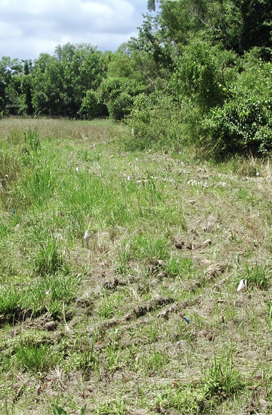
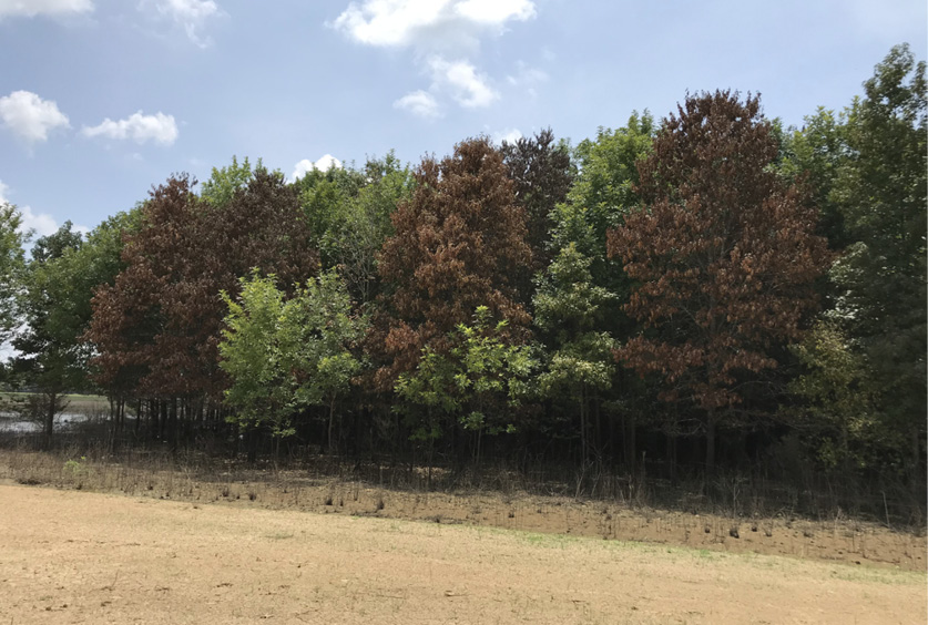
One of the most important and often neglected components of planting a new hardwood forest is site-quality assessment (Figure 1). Often, the decision is made to plant hardwood seedlings into a cutover or retired agricultural field without in-depth consideration given to what species are appropriate for that site. In these scenarios, the landowner or manager plants seedlings based on commercial appeal or wildlife habitat enhancement capabilities of a given species or group of species. This can lead to planting failure when selected species are not capable of withstanding inherent site conditions including texture, drainage, and soil chemistry.
Site evaluation is not difficult so long as the evaluator understands the process and possesses some basic information about the site being evaluated. It is important to have general knowledge of the property and know the boundaries of the site being evaluated so that a complete assessment can be performed. Questions like “When and how frequently do floods occur?”, “How long does floodwater stay on the area?”, and “Has the area ever been in agricultural production or under grazing?” help gain this understanding. The landowner, local residents, state agency personnel, aerial photographs, and other sources can be used to obtain land use history.
In addition, a basic understanding of soils and their capabilities is needed to properly judge a site’s suitability for a given tree species. Knowledge of soils is important for species selection, constraints on regeneration, and timing of silvicultural operations. One of the more common ways to obtain soil information is to use county soil surveys available at the county Natural Resources Conservation Service offices or from the Web Soil Survey website. While these surveys provide useful general soil information, more precise information is often needed when planting a hardwood forest; in many cases, a more hands-on approach is needed.
This publication offers an overview of the Baker-Broadfoot method, a more appropriate method for these efforts. It is intended to serve as a companion to A Practical Field Method of Site Evaluation for Commercially Important Southern Hardwoods (see Suggested Reading) when evaluations of site quality for bottomland hardwoods in Mississippi are made.
Site-Quality Evaluation
Evaluating site quality is important for determining the suitability of a given site for specific tree species for reforestation efforts, as well as for predicting the quality and quantity of timber production. Listed below are various techniques for evaluating site quality using trees and/or soil and site characteristics.
Direct Measurement
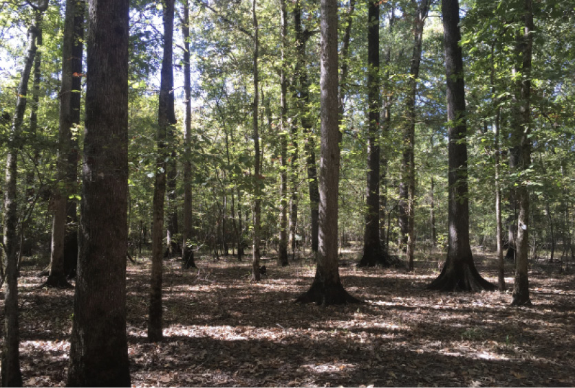
Direct measurement of site quality involves determining age and height for selected index trees and comparing these measures to site index curves (i.e., the average height of dominant and codominant trees at a given base age, usually 50 years in bottomland hardwood species). Direct measurement of index trees is the most accurate method available for determining site quality, but very few published curves are available for public use. Site index determination is the most widely used form of site quality evaluation across much of the southern United States (Figure 2).
Site index curves for bottomland and loess hills hardwood species and are available online, but use caution with these. While conditions used in development are stated with each curve, remember that they were developed using specific site conditions. It is important not to draw conclusions beyond the range of the data used in their construction.
Species Trials
If there are no suitable trees to measure site index (e.g., cutover areas, retired fields, etc.), one option is to evaluate a site by planting a single or several species of interest and observing their growth over time. This approach offers an ultimate “ground truth” but has several disadvantages: it is costly, takes many years to produce answers, and relates only to the species planted and the site (or those that are very similar) on which the trial is conducted.
Indicator Species
General estimates of site quality can sometimes be determined from the presence and size of indicator plant species. For example, the presence of pawpaw usually indicates a good cherrybark oak or swamp chestnut oak site. Likewise, the presence of buttonbush and swamp privet indicates a poor site for planting cherrybark oak; baldcypress would be a more suitable species. At present, the authors are not aware of a quantitative site evaluation system for hardwoods based on indicator species.
Soil Series
A system of soil classification has been developed for Mississippi counties by the Natural Resources Conservation Service. This system contains a site index value for selected tree species by soil series. The difficulty that arises is that soil series are not necessarily based on soil features associated with yield of desired products. Consequently, a considerable range in site index is possible within a soil series. If using soil series to evaluate a site, it is important to have experience identifying soil series correctly and to be very cautious in estimating site index within the range given for that soil series. In addition, in past surveys, forested areas often were not mapped or were mapped in such a way that sizable areas of contrasting soil types were sometimes missed or ignored.
Expert Systems
Expert-based site-evaluation systems rely on the experience and judgment of experts in the field. Few systems involve mathematical formulas, instead relying on point systems tied to important soil and site characteristics to determine site quality. Currently, only one expert system for evaluating Mississippi bottomland sites is in use.
This system, developed by authors James B. Baker and W. M. Broadfoot, relies on four key soil factors and associated soil and site properties to determine site quality for 14 commercially important bottomland hardwood species (Figure 3). The method is the most reliable approach for accurate and reliable bottomland site quality evaluation. Forest managers who want to evaluate bottomland sites for reforestation/afforestation efforts in Mississippi should print A Practical Field Method of Site Evaluation for Commercially Important Southern Hardwoods to understand the method and use it while making site evaluations; however, you must record site index values and calculate the site index for individual species by hand for each species of interest. While the manual provides an explanatory background and should be consulted while working through the method, there is a web-based tool that provides simultaneous calculation for all species. Site assessment using the Baker-Broadfoot method is explained in detail in the next section.
Baker-Broadfoot Method
The Baker-Broadfoot method of determining site quality differs from the traditional approaches discussed above. Instead of using tree heights and ages of selected index trees, Baker-Broadfoot uses soil/site factors to estimate site-quality and associated site index values for bottomland hardwood species. Baker and Broadfoot developed the technique for determining site quality based solely on soil and site characteristics. This technique is a system based on the experience of individuals with expert knowledge of soils and tree growth. The method’s accuracy has been tested against published site index curves for cherrybark oak with few differences found between each method.
Advantages of the Baker-Broadfoot method include:
- It provides accurate estimates of site index under most soil or site conditions associated with bottomland hardwoods in Mississippi.
- It does not require expert soil knowledge or even identification of soil series.
- It does not require the presence of trees on the site.
Major Soil Factors
Growth of hardwoods depends primarily on four major soil factors:
- soil physical condition
- moisture availability during the growing season
- nutrient availability
- aeration
The basis of the Baker-Broadfoot method is the assumption that each of the major soil factors listed above is responsible for a certain percentage of tree growth. These percentages are then multiplied by the maximum height on an ideal site (maximum site index) for each species to produce site quality values for each major soil factor, with site index points being assigned to various soil properties. These site index points represent a comparable number of feet of site index, which are summed to obtain the total feet of site index for each soil factor in turn. After these points are summed for each soil factor, the subtotals are added together to provide a total estimate of site index for the species being evaluated. Maximum and minimum site indices for each of the 14 species that can be evaluated using Baker-Broadfoot are listed in Table 1.
|
Species |
Maximum Site Index¹ |
Minimum Acceptable Site Index² |
|
Eastern cottonwood |
130 |
80 |
|
Green ash |
105 |
65 |
|
Hackberry/sugarberry |
100 |
55 |
|
Cherrybark oak |
125 |
70 |
|
Nuttall oak |
120 |
75 |
|
Shumard oak |
120 |
70 |
|
Swamp chestnut oak |
110 |
65 |
|
Water oak/willow oak |
115 |
70 |
|
Sweet pecan |
115 |
70 |
|
Sweetgum |
120 |
75 |
|
American sycamore |
130 |
70 |
|
Yellow-poplar |
125 |
70 |
1 Base age 30 years for eastern cottonwood, 50 years for all other species.
2 If site index is lower than numbers in this column, serious consideration should be given to not attempting regeneration of that species on the site being evaluated.
Soil and Site Properties
The proportion of growth accounted for by each major soil factor is based on contributions made by each of the soil and site properties listed below. Site index points are assigned to each soil and site property for each of three possible conditions (best, medium, and poor). These soil and site properties are assessed by first digging a soil pit at the evaluated site, with subsequent observations taken for soil/site conditions. Explanations of each soil and site property are in the following sections. Values assigned to the best category, when summed across all soil and site properties for each major soil factor, equal the maximum site index value for that species. Values associated with best, medium, and poor conditions for each soil and site property vary by species based on the expectation for its influence on growth for each of the 14 tree species.
Major Soil Factors and Associated Soil and Site Properties
Physical Condition
- Soil depth and pans
- Texture
- Compaction
- Structure
- Past use
Moisture Availability
- Water table
- Pans
- Position
- Microsite
- Structure
- Texture
- Flooding
- Past use
Nutrient Availability
- Geologic source
- Past use
- Organic matter
- Topsoil
- Soil age
- pH
Aeration
- Structure
- Swampiness
- Mottling
- Color
Soil Depth
The depth or thickness of a soil is important because it influences how easily that soil is penetrated by tree roots and water. Floodplain soils are usually considered deep due to their alluvial (deposited by floodwaters) origin. Exceptions exist in the presence of a plow pan, a rare inherent fragipan, or a high water table.
Artificial or Inherent Pans
A pan is a soil layer that is strongly compacted, hardened, or of very high clay content. They restrict root penetration and vertical movement of water through the soil. Artificial pans (plow pans or traffic pans) are layers in the soil formed by compaction from tillage operations or movement of equipment or livestock over time. These pans are evident when you feel resistance when inserting a soil probe or auger into the tightly compacted, dense, and often dry soil. Inherent pans are formed by a natural layer of soil that is harder than the soil above and below it. These pans are commonly referred to as claypans or fragipans in soil descriptions.
Texture
Soil texture is the proportion of the different size groups of soil particles in a soil. Specifically, it refers to the proportions of clay, silt, and sand. Soil lab testing can provide exact proportions. However, in the field, texture can generally be determined based on feel.
Compaction
Compaction is the process by which soil grains are rearranged/compressed to decrease air space and bring them into closer contact with one another. In most cases, the process is caused by traffic (equipment or foot) or other artificial means.
Structure
Soil structure is the combination or arrangement of soil particles into units or aggregations (called peds). These peds are often arranged in the soil so that they give a distinctive characteristic shape when broken. Some common classes of soil structure are granular, blocky, platy, prismatic, and structureless (single-grained or massive). Detailed understanding of these classifications is not needed when using the Baker-Broadfoot method; basic recognition of structure is sufficient.
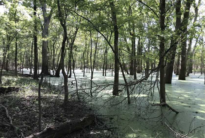
Past Use and Present Cover
Past use and present cover are important for three of the four major soil factors (Figure 4). Undisturbed soil containing mature forest cover usually results in the best tree growth. Disturbed soils, especially if cultivated in the last 20 years, result in soils containing less natural fertility and organic matter. Such conditions are usually associated with greater soil compaction, which reduces tree growth. The phrase “near virgin forest cover” contained in Baker-Broadfoot should be interpreted to mean a maturing or mature forest, regardless of whether it was harvested at some point or was an old field many decades ago.
Water Table Depth
Water table depth refers to the average depth to a non-stagnant “true” water table during the growing season (April through September). Water table depth can be determined by digging to free water or by observing water elevations in nearby streams/creeks, sloughs, lakes, ponds, etc., in relation to site elevation.
Topographic Position
Topographic position refers to the location of the site relative to the surrounding landscape. Floodplains or stream bottoms are in the current active floodplain (first bottoms). Stream terraces are in the second bottoms, while lower slopes refer to the loess bluff hills.
Microsite
Microsite is the general lay of the ground in the immediate vicinity of the soil and site properties being assessed. A concave microsite is a general depression of the site, while convex is a general rise of the site. More soil moisture is usually available for trees in concave versus level or convex areas.
Flooding
Flooding is based on the long-term flooding pattern for the area of interest (Figure 5). Personal knowledge of the site, discussion with local residents, or flooding records are good sources of information for determining long-term flooding patterns.
Geologic Source
Geologic source refers to the soil’s origin or physiographic area (a large area of land defined by its distinct geology, topography, and communities of native plants and animals). For purposes of using Baker-Broadfoot, soils in the Mississippi River, Loess, and Blackland areas are generally high in fertility, and Coastal Plain soils are typically relatively low in fertility. Also remember that the origin of a soil may not correspond with the geographic location being assessed. Floodplains are constantly undergoing soil deposition with new influxes of soil particles from upstream sources. If these newly deposited soils are traveling from a different physiographic region, identification of the geologic source should reflect this.
Organic Matter
Organic matter refers to the fraction of organic material (i.e., plant and animal material at various stages of decomposition) found in the soil. Generally speaking, soils with high organic matter content are dark in color, while soils low in organic matter content are lighter. Most forests will have 1–2 percent organic matter. Organic matter levels of less than 1 percent are usually associated with agricultural fields or agricultural fields recently taken out of row-crop production.
Depth of Topsoil
Depth of topsoil refers to the depth of the surface soil or the B-horizon (beginning of the subsoil region, usually a transition to clays). Topsoil depth can be distinguished by a rather abrupt change in soil color or texture. It is a combination of mineral soil with organic matter, is ordinarily darker in color, and is typically a coarser texture than subsoil layers.
Age
Soil age refers to the degree of soil profile development. The more distinguishable the profile (banding of soil), the older the soil is. Profile development is the movement of smaller soil particles, especially clays, deeper into the soil. Young soils generally have no profile development. (Remember that layers of different sediments from flooding events are not the same as profile development.) Intermediate-aged soils may exhibit medium or moderate profile development and show signs of profiles along a dug pit wall. Older soils have readily distinguishable profiles. Zones of leaching (downward movement of nutrients in the soil) and of small particle migration are easily seen. Such soils generally have lower natural fertility, lower pH, and possibly pans.
pH
Soil pH refers to the amount of hydrogen ions present in soil. The pH of a soil has a direct effect on availability of certain nutrients for tree growth. A pH of 7.0 is considered neutral. Values above 7.0 are basic, while values lower than 7.0 are acidic. In general, young soils on large river systems have basic pH values ranging from 7.0 to 8.5. As these soils mature, they become acidic due to organic matter decomposition and deposition of acidic atmospheric materials. Soils of smaller river systems and streams tend to be acidic, with values ranging between 4.0 and 6.5. Ridgetops, side slopes, and upper stream heads tend to be slightly acidic, while drains tend to be slightly acidic to slightly basic. Tree species also have preferences for limited ranges of soil pH. Oaks do better in slightly acidic to acidic soil conditions, while many riverfront hardwood species (e.g., cottonwood and green ash) do better on neutral to slightly basic soil conditions.
Swampiness
Swampiness does not mean the same thing as flooding (Figure 6). Swampiness is determined observationally to approximate the amount of soil pore space available for root gas exchange. “Wet in winter only” allows for ample soil pore space for growing season gas exchange. “Wet from January to July” indicates potentially limited available pore space during the first half of the growing season. “Waterlogged all year” indicates a wet site with little available pore space for gas exchange throughout the growing season. Such conditions limit not only tree growth but also species composition.
Mottling
Mottling is spots or blotches of different colors (normally gray, yellow, or light brown) interspersed within the dominant color of the soil. Mottling forms when poor internal drainage and aeration of the soil causes anaerobic bacteria (bacteria that thrive without oxygen) to grow and color the soil as they die and are reabsorbed.
Color
Soil color in the rooting zone is an indication of the amount of air and water contained in the soil. A black, brown, or red soil indicates a well-aerated soil that also has good moisture availability. A yellow or brownish-gray soil indicates saturated conditions during a part of the year with less available oxygen for roots. A gray soil indicates extended periods of saturation with little available oxygen for roots.
Using the Baker-Broadfoot Method
As mentioned, an individual wanting to use the Baker-Broadfoot method should obtain a physical copy of A Practical Field Method of Site Evaluation for Commercially Important Southern Hardwoods and use it to assess soil/site properties of the site of interest. As the reader follows the manual’s steps for assigning site index points for different species, the information detailed above is intended to help them decide which condition (best, medium, or poor) best suits the soil/site property for the species they are assessing.
Baker and Broadfoot offer a hypothetical site with conditions typical for similar sites. Assume a recently retired agricultural field in the Mississippi River floodplain is the site of interest for establishing a bottomland hardwood plantation. The site has been in agricultural row crop production for decades. It is level and does not flood. The soil is a loam and does not exhibit profile development. It is granular in structure but is moderately compacted with a plow pan 10 inches under the surface. The soil color is brown and does not exhibit mottling in the top 24 inches of soil. During the growing season, the water table depth is 5 feet, the soil pH is 6.5, and the A-horizon contains less than 1 percent organic matter.
Assuming cottonwood is the species of interest for planting, using a copy of A Practical Field Method of Site Evaluation for Commercially Important Southern Hardwoods, answer the soil/site condition questions for each site factor. Using the example site information from the preceding paragraph, the correct answers are in maroon and followed by an asterisk in Tables 2–5. Site index points are summed to give the user a total of 89, which is the corresponding estimation of site index for cottonwood on the example site. Using Table 1, a site index for cottonwood of 89 is above the minimum acceptable site index for the species. Assuming quality cuttings, proper planting techniques, and appropriate weed control, cottonwood planting efforts should be successful at the example location.
The following tables show an example of evaluating soil/site conditions for cottonwood using the Baker-Broadfoot method based on four factors. The correct answers are in maroon and followed by an asterisk. The example is adapted from the work of Baker and Broadfoot.
|
Soil-Site Property |
Soil-Site Condition and Relative Quality |
||
|
Best |
Medium |
Poor |
|
|
Soil depth, presence of pan |
Deep soil (>4 ft); no pan [16 points] |
Medium depth (2–4 ft), or plow pan present [11 points*] |
Shallow soil (<2 ft), has inherent pan [-11 points] |
|
Texture (in rooting zone) |
Medium-textured; silty or loamy |
Coarse-textured; sandy [8 points] |
Fine-textured; clayey [-4 points] |
|
Compaction (in surface foot) |
No compaction; loose, porous soil [9 points] |
Moderately compacted; firm, moderately tight [6 points*] |
Strongly compacted; tight soil [-3 points] |
|
Structure (in rooting zone) |
Granular; structureless, single-grained if sandy, massive if loamy or silty [5 points*] |
Prismatic; blocky [3 points] |
Massive (if clayey); platy [-3 points] |
|
Past use and present cover |
Undisturbed; near-virgin forest cover [5 points] |
Moderate cultivation; cultivated <20 years; or open with grass cover [2 points] |
Intensive cultivation; cultivated >20 years, or open and bare [-2 points*] |
*The correct answers are in maroon and followed by an asterisk.
|
Soil-Site Property |
Soil-Site Condition and Relative Quality |
||
|
Best |
Medium |
Poor |
|
|
Water table depth |
2–6 ft [10 points*] |
1–2 ft or 7–10 ft [7 points] |
<1 ft [unsuitable] >10 ft [0 points] |
|
Artificial or inherent pan |
No pan [9 points] |
Plow pan [6 points*] |
Inherent pan [-6 points] |
|
Topographic position |
Floodplain or stream bottom |
Stream terrace or lower slope [5 points] |
Upland [-5 points] |
|
Microsite |
Concave; depression, pocket, trough [7 points] |
Level; flat [5 points*] |
Convex; ridge, mound [-2 points] |
|
Structure (in rooting zone) |
Granular; structureless, massive (if silty, loamy, or clayey); stratified |
Prismatic; blocky [3 points] |
Structureless, single-grained (if sandy); platy [-3 points] |
|
Texture (in rooting zone) |
Silty or loamy (or stratified) |
Clayey [2 points] |
Sandy [-2 points] |
|
Flooding |
Winter through spring [2 points] |
Winter only [1 point] |
None [-1 point*] Continuous [unsuitable] |
|
Past use and present cover |
Undisturbed; near-virgin forest cover [2 points] |
Moderate cultivation; cultivated <10 years or open with grass cover [1 point] |
Intensive cultivation; cultivated >10 years or open and bare [-1 point*] |
*The correct answers are in maroon and followed by an asterisk.
|
Soil-Site Property |
Soil-Site Condition and Relative Quality |
||
|
Best |
Medium |
Poor |
|
|
Geologic source |
Mississippi River, Loess, Blackland [8 points*] |
Mixed Coastal Plain and other [5 points] |
Coastal Plain [-5 points] |
|
Past use and present cover |
Undisturbed; near-virgin forest cover, cultivated <5 years [5 points] |
Moderate cultivation; cultivated 5–10 years or open with grass [3 points] |
Intensive cultivation; cultivated >10 years, or open and bare [-3 points*] |
|
Organic matter |
>2% [4 points] |
1–2% [3 points] |
<1% [-3 points*] |
|
Depth of topsoil |
>6 in or not profile development |
3–6 in [2 points] |
<3 in [-2 points] |
|
Soil age |
Young, no profile development |
Medium, moderate profile development [2 points] |
Old, well-developed profile, leached [-2 points] |
|
pH (in rooting zone) |
5.5–7.5 [3 points*] |
4.5–5.5 or 7.5–8.5 [2 points] |
<4.5 or >8.5 [-2 points] |
*The correct answers are in maroon and followed by an asterisk.
|
Soil-Site Property |
Soil-Site Condition and Relative Quality |
||
|
Best |
Medium |
Poor |
|
|
Soil structure (in rooting zone) |
Granular, porous; structureless, single-grained if sandy, massive if loamy or silty [3 points*] |
Prismatic; blocky [2 points] |
Massive (if clayey); platy [-2 points] |
|
Swampiness |
Wet in winter only [3 points*] |
Wet January to July [2 points] |
Waterlogged all year [unsuitable] |
|
Mottling |
None to 18 inches [3 points*] |
None to 8 inches [2 points] |
Mottled to surface or gray mineral soil [-2 points] |
|
Soil color (in rooting zone) |
Black, brown, red [3 points*] |
Yellow, brownish-gray [2 points] |
Gray [-2 points] |
*The correct answers are in maroon and followed by an asterisk.
Final Considerations
Another advantage of the Baker-Broadfoot method is its flexibility. If a forest manager using the method is unsure of which condition to assign to a specific soil or site property, they can estimate between any two conditions—best/medium or medium/poor. For example, it is often difficult to determine the exact water table depth during the growing season. If you are unable to determine the exact depth onsite, you can split the difference between site quality values. While this is not recommended for every soil and site property, occasionally doing so may lead to more accurate estimates of site quality.
The number of evaluations to make on a particular site is related to the variability of the site. In general, no more than three to five evaluations should be necessary for each specific site condition.
Suggested Reading
Aust, W. M., & Hodges, J. D. (1988). A comparison of methods for estimating cherrybark oak site index. Southern Journal of Applied Forestry, 12, 115–116.
Baker, J. B., & Broadfoot, W. M. (1979). A practical field method of site evaluation for commercially important southern hardwoods. USDA Forest Service General Technical Report SO-26.
Belli, K. L., Hodges, J. D., & Goelz, J. C. G. (1998). Site productivity assessment for cherrybark oak on minor stream bottoms in Mississippi: A comparison of methods. Southern Journal of Applied Forestry, 22, 7–10.
Lockhart, B. R. (2013). Site index determination techniques for southern bottomland hardwoods. Southern Journal of Applied Forestry, 37, 5–12.
Self, B. (2020). Bottomland hardwood management species/site relationships. Mississippi State University Extension, P2004.
Self, B. (2022). Soil pH and tree species suitability in Mississippi. Mississippi State University Extension, P2311.
The information given here is for educational purposes only. References to commercial products, trade names, or suppliers are made with the understanding that no endorsement is implied and that no discrimination against other products or suppliers is intended.
Publication 4004 (POD-06-24)
By Brady Self, PhD, Associate Extension Professor, Forestry, and Brian Lockhart, Research Forester, United States Forest Service (retired).

The Mississippi State University Extension Service is working to ensure all web content is accessible to all users. If you need assistance accessing any of our content, please email the webteam or call 662-325-2262.
