Extension Matters
Volume 12 Number 1
Phenology Fun
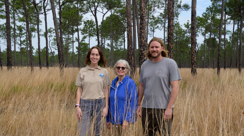
Emmett Carstens, plant ecologist at the Grand Bay National Estuarine Research Reserve; Gail Bishop, former coordinator of the Gulf Coast Phenology Trail; and Dr. Jonathan Pitchford, Extension stewardship coordinator at the Grand Bay National Estuarine Research Reserve, visit a Gulf Coast Phenology Trail observation site.
Extension supports Gulf Coast phenology trail
Story by Bonnie Coblentz | Photos by Kevin Hudson and submitted
A trail along the Mississippi Gulf Coast is engaging members of the public in outdoor learning and community science, allowing citizen scientists to record their careful observations of wildlife and plant life in a way that contributes meaningful data to scientific research.
The Mississippi State University Extension Service is a major partner in the Gulf Coast Phenology Trail that spans the southern portion of the state. There are 26 active locations on this trail where various numbers of individual plants are marked for observation, and almost half of the observation sites are located on the Mississippi Gulf Coast, in Hancock, Harrison, and Jackson counties.
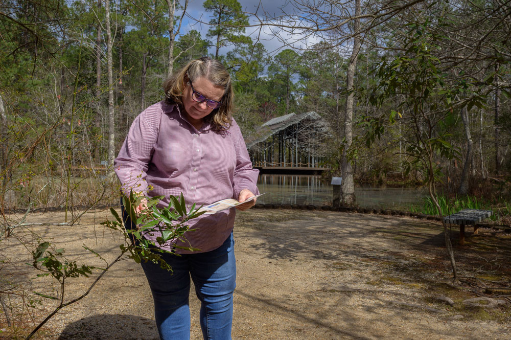
Pat Drackett is director of the MSU Crosby Arboretum in Pearl River County, another location on this trail. Currently, The Crosby Arboretum has 18 plants that trail walkers observe and record.
“In addition to preserving and showcasing the natural beauty of the region, this is one of the multiple purposes The Crosby Arboretum serves,” Drackett explains. “Data is collected here and uploaded so it can be helpful to researchers.”
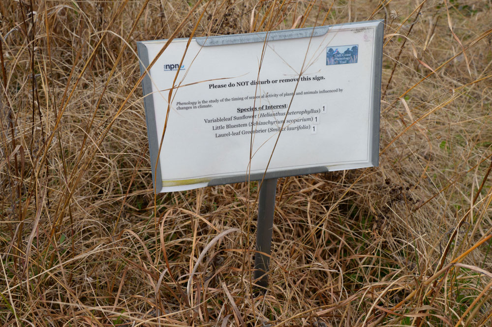
Generally speaking, phenology involves observing nature’s calendar. Specifically, it is the scientific study of the timing of recurring natural events and how these events are influenced by seasonal changes, weather, and climate. A phenology trail is a designated path where this data is collected at specific locations.
Observers are trained in how to collect scientifically significant information and input their data into an app on their phone called Nature’s Notebook. The information is then evaluated to identify the timing of natural events, trends, and indications of human activity affecting natural events.
Emmett Carstens is the plant ecologist at the Grand Bay National Estuarine Research Reserve—part of the Mississippi Department of Marine Resources—involved with the Gulf Coast Phenology Trail.
“This trail was started in 2016 in an effort to engage state and federal partners, nongovernmental partners, in gathering long-term phenological data,” Carstens emphasizes. “I coordinate all the people who are considered community scientists or trained phenology observers.”
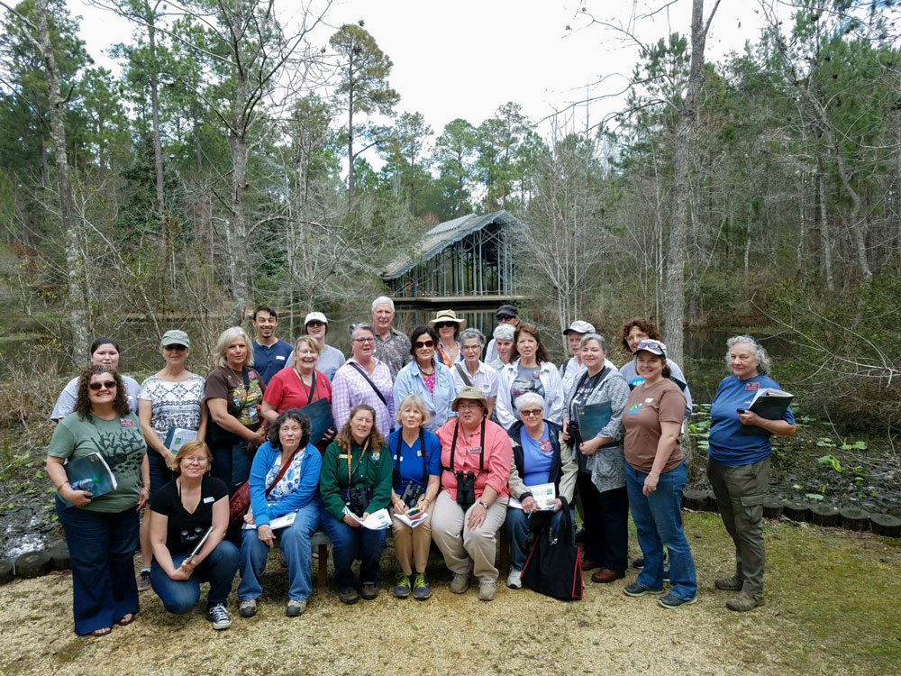
These people—a mix of retired naturalists, students, Scouting America members, and more—monitor the locations on the trail, typically every week. Carstens says observers are trained both in the classroom and in field locations on how to make and record accurate observations.
The collected data is made publicly available through the USA National Phenology Network Database, Carstens shares.
This information can inform land management decisions and reveal trends in how phenology of several native focal species is changing across the Gulf Coast.
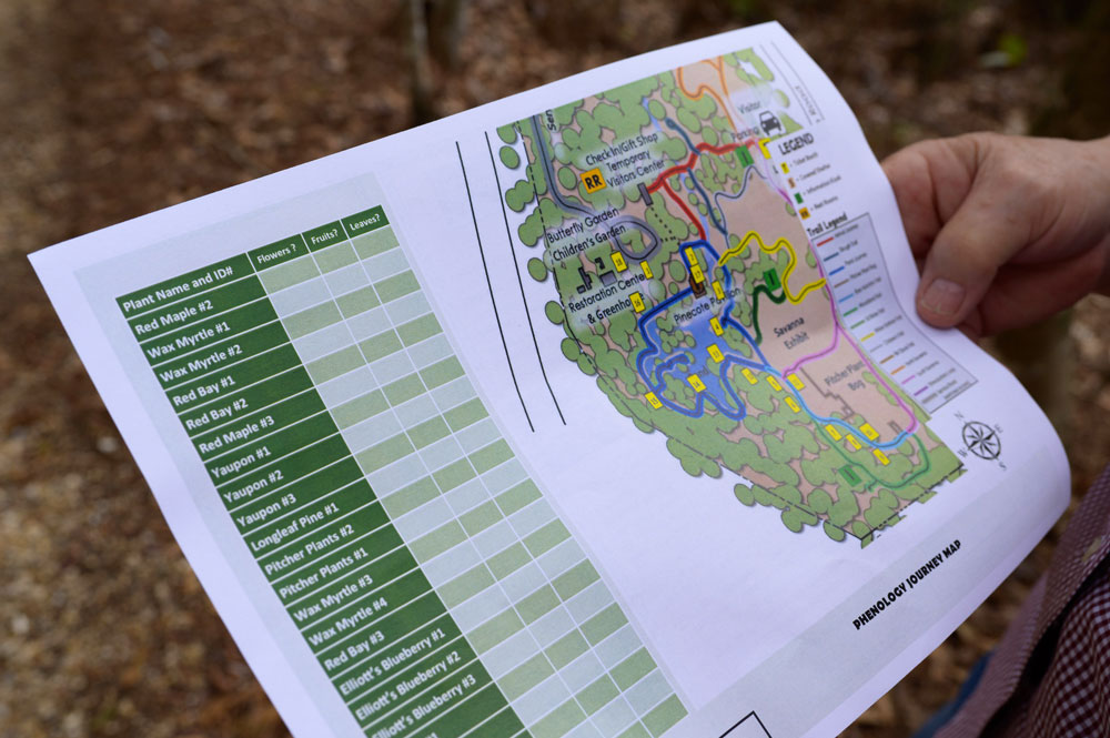
Sites on the Mississippi coast trail, along with The Crosby Arboretum in Picayune, include the Mississippi Sandhill Crane National Wildlife Refuge in Vancleave, the Walter Anderson Museum of Art in Ocean Springs, and the Pascagoula River Audubon Center in Moss Point.
“In addition to looking at the plants tagged in each location, we’re looking at some pollinators and migratory birds,” Carstens says. “What the observers see and record changes by the time of the year and amongst different locations.”
Jonathan Pitchford, Extension stewardship coordinator at the Grand Bay National Estuarine Research Reserve, says the Gulf Coast Phenology Trail is part of the Extension’s Coastal Upland Restoration and Ecology Program.
“We promote the trail, apply for grants to enhance the trail, and work closely with our partners to train volunteers and to understand phenological trends in our region,” Pitchford explains. “We see value in the trail as a way to encourage people of all ages to get outside and observe nature.”
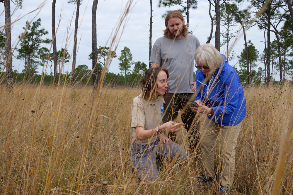
Gail Bishop, former coordinator of the Gulf Coast Phenology Trail, continues to make and record observations at different locations on the trail.
“This is a nationwide program to observe, collect data that can be useful to scientists, and it educates the observers because they are learning to look at nature with their own eyes and record what they see,” Bishop emphasizes.
She says red maple is probably the No. 1 plant most observed across the United States. Maps show where the red maple is in its life cycle, and this data is used in part to determine spring’s arrival across various locations.
The 2024 Gulf Coast Phenology Trail Annual Report details red maple phenological trends over the past few years.
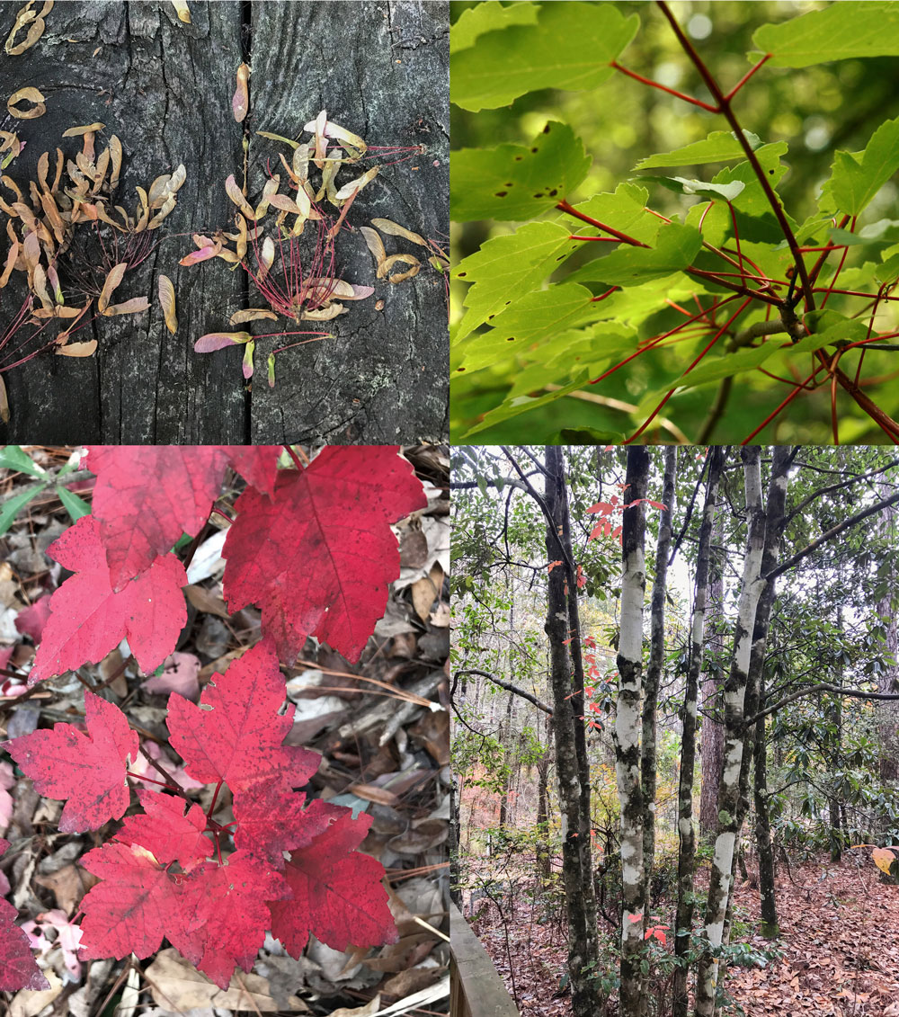
Bishop says another example of how this data is used is in the management efforts to contain Chinese tallow, a highly invasive species of tree in the southeast United States.
“Land managers want to know when is a good time to spray herbicides for Chinese tallow control because there is an optimum time to do that,” Bishop says. “By observers recording the information on this tree, land managers can make decisions on when to act.”
Authors
-
 Senior Extension Associate
- Agricultural Communications